The Prairie Pothole Easement War: How Decades-Old Duck Habitat Contracts Became America’s Quietest Land-Rights Battle
The Prairie Pothole Easement War: How Decades-Old Duck Habitat Contracts Became America’s Quietest Land-Rights Battle
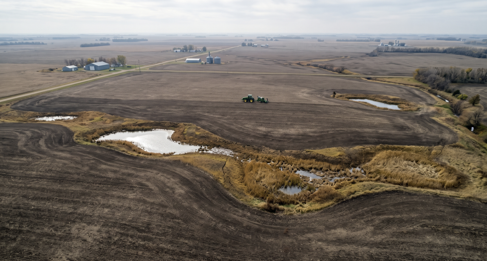
Across the wind-swept plains of southeastern North Dakota, thousands of shallow, glacier-carved depressions dot some of the richest black-earth farmland in North America. Known to ecologists as "prairie potholes"—and celebrated internationally as North America’s premier breeding ground for migratory waterfowl—these seasonal basins sit at the center of one of the least-reported yet most consequential property-rights battles unfolding in United States federal courts.
While national headlines remain saturated with congressional spending standoffs and Wall Street volatility, third-generation grain farmers in North Dakota’s LaMoure County are locked in active federal litigation against the U.S. Fish and Wildlife Service (FWS). At stake is the meaning of one-page perpetual conservation easements signed by their grandparents during the 1960s—agreements that promised farmers could continue "normal farming practices", but which federal regulators now interpret as banning modern subsurface drainage systems across nearly 40 percent of active cropland.
Unlike high-profile urban zoning disputes, the Prairie Pothole easement conflict plays out far from television cameras, pitting multi-generational family farms and rural drainage contractors against federal wildlife wardens wielding criminal prosecution powers under statutes passed during the administration of Herbert Hoover.
What Is the Prairie Pothole Region—and How Did the 1960s Contracts Work?
Stretching across roughly 300,000 square miles of the Upper Midwest—encompassing North Dakota, South Dakota, Minnesota, Montana, and Iowa—the Prairie Pothole Region was sculpted more than 10,000 years ago when retreating Ice Age glaciers left behind millions of shallow depressions. Some hold water permanently, while millions of others remain dry for most of the year, collecting snowmelt briefly in spring before drying out in time for summer row-crop planting.
In the late 1950s and 1960s, Congress amended the Migratory Bird Hunting Stamp Act to authorize the U.S. Fish and Wildlife Service to purchase permanent conservation easements from struggling Plains farmers. Under these agreements, landowners received a modest one-time lump-sum payment—often just a few dollars per acre—in exchange for promising not to burn, level, fill, or intentionally drain the specific wetland depressions mapped on their property.
Crucially, however, federal agents assured rural families that the contracts were narrow wildlife covenants, not total land takeovers. The standard easement deeds explicitly preserved the landowner’s right to carry out "normal farming practices", including plowing, seeding, harvesting, and grazing whenever the shallow basins dried out naturally.
The Technological Shift: Subsurface Drain Tile vs. Federal Buffer Zones
For decades, the arrangement operated with minimal friction. Beginning in the early 2000s, however, agricultural engineering across the Northern Plains underwent a quiet technological transformation: the widespread adoption of precision subsurface drain tile.
Unlike open surface ditches that visibly gouge through a wetland basin, modern perforated plastic drain tiles are buried three to four feet beneath the soil surface. Their purpose is not to empty ponds, but to lower excessively high groundwater tables in surrounding crop fields so plant roots do not drown during wet spring cycles.
Alarmed that subsurface drainage near mapped potholes could subtly accelerate water seepage out of seasonal basins, the U.S. Fish and Wildlife Service began issuing strict new technical directives—culminating in regulatory interpretations that establish mandatory no-drainage buffer zones around every protected pothole, even tiny depressions measuring less than a tenth of an acre that remain bone-dry in most years.
| Legal & Agricultural Dimension | 1960s Original Easement Bargain | Modern FWS Enforcement Position | North Dakota Farmers’ Legal Challenge |
|---|---|---|---|
| Geographic Scope | Restricted strictly to mapped wetland depressions ("potholes"). | Imposes uncompensated setback buffers (e.g., 190 feet) into surrounding dry upland cropland. | Buffers confiscate up to 40% of productive fields never covered by the original deeds. |
| Permitted Land Use | Expressly protects all "normal farming practices" on the property. | Treats subsurface agricultural drain tiling as prohibited wetland draining. | Argues routine soil-moisture management is a standard agricultural practice protected by contract. |
| Mapping Precision | Hand-drawn 1960s aerial photo overlays with approximate boundaries. | Retroactively expands protected zones using modern LiDAR and satellite modeling. | Contends federal agencies cannot unilaterally rewrite fixed real-estate deeds decades later. |
| Enforcement Mechanism | Civil contract compliance monitored locally. | Criminal misdemeanor prosecution, fines, and forced excavation of installed tiles. | Seeks declaratory judgment in federal court barring retroactive agency reinterpretation. |
Inside the LaMoure County Lawsuits: Cody Peterson and Ellingson Drainage
The human and economic toll of this regulatory expansion came into sharp focus through federal lawsuits filed in North Dakota by LaMoure County farmer Cody Peterson and agricultural drainage contractor Ellingson Drainage, Inc., represented by public-interest attorneys from the Pacific Legal Foundation.
On Peterson’s third-generation family farm—where he grows corn, soybeans, wheat, and edible beans—FWS officials mapped 21 separate wetland depressions scattered across a single field and notified him that installing subsurface drain tile within 190 feet of any of those spots was strictly forbidden. When Peterson’s agricultural engineering consultants plotted those overlapping 190-foot circles onto his field map, the federal directive effectively sterilized at least 40 percent of his farmable acreage, leaving crops vulnerable to standing water and soil salinity.
The ripple effects extend well beyond individual farm families:
- Secondary Industry Paralysis: Specialized agricultural contractors like Ellingson Drainage—which employs hundreds of rural workers across the Upper Midwest—reported widespread project cancellations as farmers feared federal criminal prosecution if drain tiles crossed invisible regulatory setback lines.
- Local Municipal Road Maintenance: Even rural local governments have been swept into the dispute. In a parallel North Dakota conflict, FWS initially barred Northland Township from digging routine roadside drainage ditches to prevent road washouts, backing down only after facing a federal court challenge.
- The Eminent Domain Workaround: Property-rights scholars note that if federal wildlife officials want to restrict farming on dry upland buffers surrounding potholes, the Fifth Amendment provides a clear mechanism: purchasing new easements at fair market value. Instead, landowners argue, the agency used administrative guidance letters to expand 60-year-old contracts for free.
A Broader Pattern in American Administrative & Land Law
Legal analysts tracking federal docket trends point out that the Prairie Pothole litigation belongs to a broader wave of U.S. property and administrative law disputes in which citizens are challenging how government agencies interpret decades-old land covenants and statutory authorities. Much like multi-generational Texas landowners who dusted off a 1951 water treaty boundary to halt modern border construction in San Ygnacio’s forgotten Falcon Dam precedent, or federal appellate battles over sovereign property takings in 28 U.S.C. § 1498 patent eminent domain law, the North Dakota cases test whether federal agencies can expand the reach of historical contracts without returning to Congress or paying just compensation.
Following the U.S. Supreme Court’s landmark 2024 decision overturning Chevron deference—which ended the era in which federal courts automatically deferred to agency interpretations of ambiguous statutes—rural landowners across the Midwest are pressing federal judges to enforce the plain, original text of 1960s easement contracts as written rather than deferring to modern bureaucratic manuals.
What Happens Next on the Northern Plains
As appellate motions and evidentiary challenges advance through federal court in late 2026, the outcome of the Prairie Pothole easement cases will govern the management of more than three million acres of private farmland across the Dakotas and Minnesota. For conservationists, preserving migratory bird flyways remains an urgent ecological priority; for rural families, the survival of multi-generational farms depends on whether a handshake and a one-page contract signed in 1965 still mean what they said on the day they were signed.
Related articles